
ISIS Threat Assessment Map – Iraq | July 2026
- July 6, 2026
- Posted by: Syria Monitor
- Categories: DATA & MONITORING, Incident Tracking
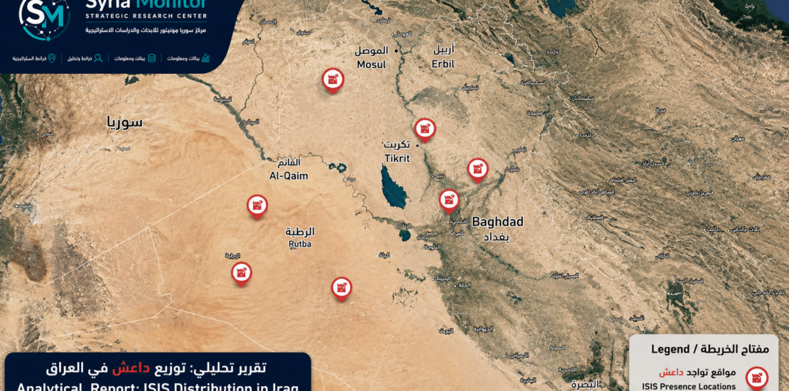
The Syria Monitor Strategic Research Center publishes its ISIS Threat Assessment Map for Iraq – July 2026, providing an analytical assessment of the geographical distribution of ISIS activity and the areas that continue to present the highest security risks.
The assessment is based on continuous field monitoring, operational reporting, historical activity patterns, terrain analysis, and the group’s demonstrated capability to maintain active cells across multiple regions of Iraq.
The highest threat levels remain concentrated in the western Nineveh Desert, Al-Hadr district, the western Anbar Desert extending from Rutba to Akashat, as well as Makhoul Hills, Hamrin Hills, and the Al-Tarmiyah district north of Baghdad. These areas continue to serve as operational environments that enable ISIS cells to conduct attacks, maintain logistical movement, and exploit difficult terrain and security gaps.
Rather than reflecting only recent attacks, the assessment evaluates a broader range of indicators, including operational freedom of movement, historical trends, geographic conditions, intelligence reporting, and the potential for future activity. As a result, the map should be understood as a dynamic threat assessment rather than a record of incidents alone.
The ISIS Threat Assessment Map forms part of the Security Indicators Series issued by the Syria Monitor Strategic Research Center, aiming to provide researchers, policymakers, and media organizations with reliable, evidence-based assessments of extremist threats across Iraq.
Syria Monitor – Strategic Research Center
www.symonitor.com
info@symonitor.com